Aerial Photogrammetric Surveying and 3-D Modeling
Cotton, Shires and Associates, Inc. (CSA) has developed an aerial surveying program using small unmanned aircraft systems (sUAS). CSA employs multiple FAA certified Commercial Remote Pilots and specilized software to create high precision 3D models of small and large sites. Aerial mapping allows our team to survey previously unreachable or unsafe areas that cannot be surveyed using traditional methods.
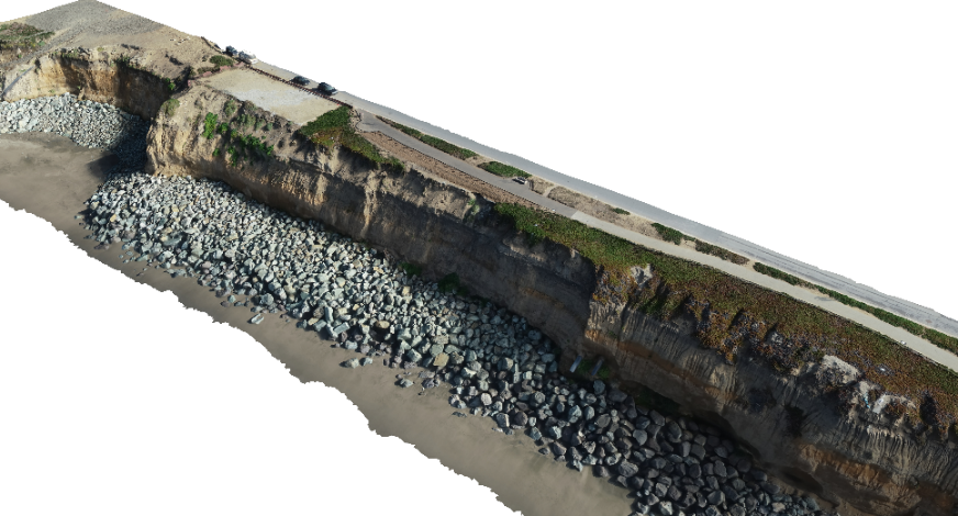
CSA uses an sUAS to capture a large number of high-resolution photographs over the desired area that include nadir (vertical) and oblique view angles. The photos are then imported into a photogrammetric software suite that transforms the 2D images into a 3D digital spatial model using Structure from Motion (SfM) technology.
Prior to the flight, 3D ground control points (GCPs) are installed and surveyed using our high precision integrated GNSS system. These GCPs allow the 3D model to be spatially translated into accurate real-world coordinates. The GCPs are also used to check the overall accuracy of the final product. CSA has produced models that are accurate to less than 1 cm in optimal conditions.
Products of our photogrammetric surveys include:
- High-resolution photographs
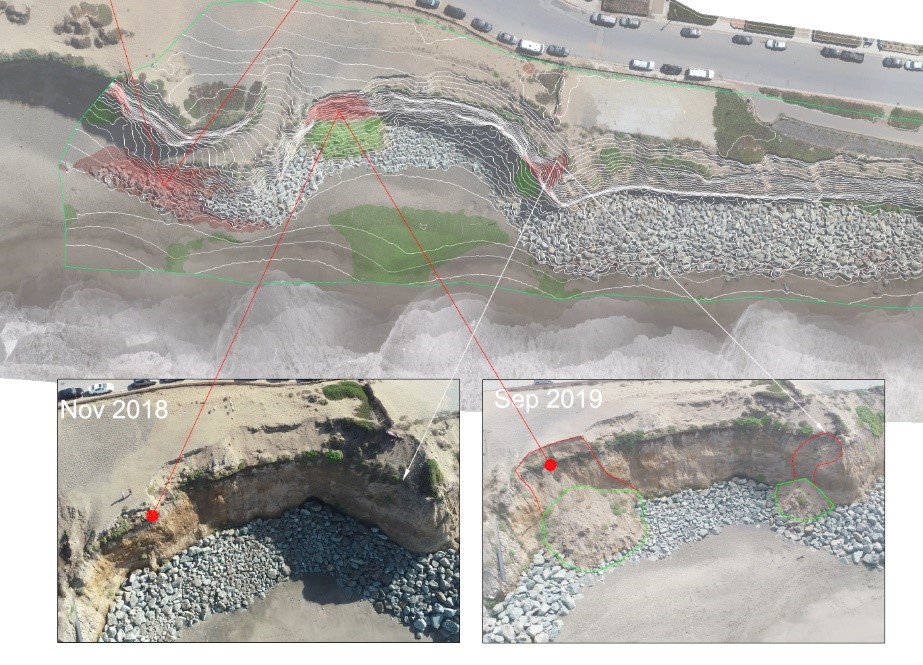
- 3D Digital Models and contours
- 3D Point Clouds
- Orthophotomosaic
The 3D models created with this method also allow for rapid and accurate volume measurements. Multiple flights allow for the measurement and monitoring of earth movement and construction progress (see figure above where red shows depletion areas and green shows areas of accumulation).